


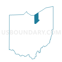
Voting District 093999, Lorain County, Ohio
About
Outline

Summary
| Unique Area Identifier | 648877 |
| Name | Voting District 093999 |
| County | Lorain County |
| State | Ohio |
| Area (square miles) | 428.45 |
| Land Area (square miles) | 0.00 |
| Water Area (square miles) | 428.45 |
| % of Land Area | 0.00 |
| % of Water Area | 100.00 |
| Latitude of the Internal Point | 41.63275910 |
| Longtitude of the Internal Point | -82.15194570 |
Maps


Graphs
Select a template below for downloading or customizing gragh for Voting District 093999, Lorain County, Ohio


Neighbors
Neighoring Voting District (by Name) Neighboring Voting District on the Map
- Voting District 007999, Cuyahoga County, OH
- Voting District BAY VILLAGE-04- E, Cuyahoga County, OH
- PRECINCT AVON LAKE CITY 1-A, Lorain County, OH
- PRECINCT AVON LAKE CITY 1-E, Lorain County, OH
- PRECINCT AVON LAKE CITY 2-E, Lorain County, OH
- PRECINCT AVON LAKE CITY 3-A, Lorain County, OH
- PRECINCT AVON LAKE CITY 3-B, Lorain County, OH
- PRECINCT AVON LAKE CITY 4-A, Lorain County, OH
- PRECINCT AVON LAKE CITY 4-B, Lorain County, OH
- PRECINCT AVON LAKE CITY 4-D, Lorain County, OH
- PRECINCT LORAIN CITY 1-G, Lorain County, OH
- PRECINCT LORAIN CITY 2-A, Lorain County, OH
- PRECINCT LORAIN CITY 2-E, Lorain County, OH
- PRECINCT LORAIN CITY 2-F, Lorain County, OH
- PRECINCT LORAIN CITY 7-B, Lorain County, OH
- PRECINCT LORAIN CITY 7-D, Lorain County, OH
- PRECINCT LORAIN CITY 7-F, Lorain County, OH
- PRECINCT LORAIN CITY 7-G, Lorain County, OH
- PRECINCT LORAIN CITY 8-A, Lorain County, OH
- PRECINCT LORAIN CITY 8-E, Lorain County, OH
- PRECINCT SHEF. LAKE CITY 1-A, Lorain County, OH
- PRECINCT SHEF. LAKE CITY 3-A, Lorain County, OH
- PRECINCT SHEF. LAKE CITY 4-B, Lorain County, OH
- PRECINCT VER 1-A, Erie County, OH
- PRECINCT VERMILION CITY 1-A, Lorain County, OH
- PRECINCT VERMILION CITY 4-A, Lorain County, OH
- PRECINCT VERMILION CITY 4-B, Lorain County, OH
- WATER, Erie County, OH
Top 10 Neighboring County Subdivision (by Population) Neighboring County Subdivision on the Map
- Lorain city, Lorain County, OH (64,097)
- Avon Lake city, Lorain County, OH (22,581)
- Bay Village city, Cuyahoga County, OH (15,651)
- Sheffield Lake city, Lorain County, OH (9,137)
- Brownhelm township, Lorain County, OH (7,618)
- Vermilion township, Erie County, OH (4,945)
- Vermilion city, Erie County, OH (4,742)
- County subdivisions not defined, Erie County, OH (0)
- County subdivisions not defined, Cuyahoga County, OH (0)
- County subdivisions not defined, Lorain County, OH (0)
Top 10 Neighboring Place (by Population) Neighboring Place on the Map
- Lorain city, OH (64,097)
- Avon Lake city, OH (22,581)
- Bay Village city, OH (15,651)
- Vermilion city, OH (10,594)
- Sheffield Lake city, OH (9,137)
Top 10 Neighboring Unified School District (by Population) Neighboring Unified School District on the Map
- Lorain City School District, OH (54,426)
- Amherst Exempted Village School District, OH (23,707)
- Avon Lake City School District, OH (22,577)
- Bay Village City School District, OH (15,651)
- Vermilion Local School District, OH (14,543)
- Sheffield-Sheffield Lake City School District, OH (13,123)
- School District Not Defined (Water), OH (4)
Top 10 Neighboring State Legislative District Lower Chamber (by Population) Neighboring State Legislative District Lower Chamber on the Map
- State House District 57, OH (136,935)
- State House District 58, OH (120,471)
- State House District 16, OH (118,044)
- State House District 56, OH (113,103)
- State House District 80, OH (110,118)
- State House Districts not defined, OH (0)
Top 10 Neighboring State Legislative District Upper Chamber (by Population) Neighboring State Legislative District Upper Chamber on the Map
- State Senate District 13, OH (370,509)
- State Senate District 2, OH (363,296)
- State Senate District 24, OH (359,580)
- State Senate Districts not defined, OH (0)
Top 10 Neighboring 111th Congressional District (by Population) Neighboring 111th Congressional District on the Map
- Congressional District 13, OH (649,102)
- Congressional District 9, OH (619,010)
- Congressional District 10, OH (599,205)
Top 10 Neighboring Census Tract (by Population) Neighboring Census Tract on the Map
- Census Tract 974, Lorain County, OH (10,233)
- Census Tract 972, Lorain County, OH (7,690)
- Census Tract 301, Lorain County, OH (6,545)
- Census Tract 212, Lorain County, OH (5,801)
- Census Tract 401, Erie County, OH (5,652)
- Census Tract 103, Lorain County, OH (5,261)
- Census Tract 1301.03, Cuyahoga County, OH (4,526)
- Census Tract 102, Lorain County, OH (4,268)
- Census Tract 224, Lorain County, OH (4,150)
- Census Tract 211, Lorain County, OH (3,336)
Top 10 Neighboring 5-Digit ZIP Code Tabulation Area (by Population) Neighboring 5-Digit ZIP Code Tabulation Area on the Map
- 44052, OH (29,850)
- 44012, OH (22,581)
- 44053, OH (18,256)
- 44089, OH (15,899)
- 44140, OH (15,651)
- 44054, OH (12,591)